About Us
Suna-West Constituency
Suna West Constituency, Constituency Number 256, was established following electoral boundary delimitation in 2012. It is one of the eight (8) constituencies constituting Migori County. It was constituted in 2013 when the then Migori Constituency was divided into Suna East and Suna West constituencies respectively. This came after the promulgation of the 2010 Constitution which unveiled new constituencies.
Suna West Constituency is bordered by Kuria West Constituency to the South East, the Republic of Tanzania to the South, Nyatike Constituency to the West and Suna East Constituency to the East. Suna West Constituency is located 170km South West of Kisumu City and about 470 km North West of Nairobi the capital city of Kenya. It is touches south western Kenyan boarder with the Tanzania a few kilometers away from Muhuru Bay.
Suna West Constituency has a population of 94,127 (2009, Kenya Population and Housing Census) and a population density of 201. It has a growth rate of 3.2%. The bulk of the population is youthful with slightly over 50% aged below 15 years, about 75% are aged below 30 years and those aged above 65 years account for 4%. The Constituency is home to the Suba people who are amalgamation of different clans and ethnic communities namely: Wasweta, Katiga, Kaksingiri, Kanyameda, Watongo, Wanayara, Kakyenga, Wanjare, Kakberi, Wakwera, Kadika, Chula, Wagasi, Wagire, Waturi, and Wiga. Recent migration from other parts of Kenya has significantly contributed to the rising population in the sub-county. Consequently, there are significant numbers of Gusii, Luos, Luhya, Kuria, Rieny, Somali, Wanubi, Kikuyus and others. In general, it is relatively cosmopolitan. The reasons for this migration trends include good agricultural soils, rapid infrastructural development, and urbanization in Migori Town and centres like Masara, Bondo Nyironge and Giribe. Both mining and cross border business activities have also contributed to the rapid population growth.
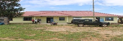
Major economic activities in the constituency include agricultural production, mining boda-boda transport and commercial activities. Agricultural activities are in terms of food and cash crops production. The major food crops grown are maize, millet, sweet potatoes, cassava and groundnuts. The cash crops are tobacco and sugarcane. There is also small-scale horticultural farming. There is also the mining of gold.
Access NG-CDF Information on your Mobile


County Assembly Wards in Suna-West Constituency :
Wiga Ward
- County Assembly Ward No.:
- County Assembly Ward Name: Wiga
- County Assembly Ward Population (Approx.):
- County Assembly Ward Area In Sq. Km (Approx.):
- County Assembly Ward Description:
Wasweta II Ward
- County Assembly Ward No.:
- County Assembly Ward Name:Wasweta II
- County Assembly Ward Population (Approx.):
- County Assembly Ward Area In Sq. Km (Approx.):
- County Assembly Ward Description:
Ragana – Oruba Ward
- County Assembly Ward No.:
- County Assembly Ward Name:Ragana – Oruba
- County Assembly Ward Population (Approx.):
- County Assembly Ward Area In Sq. Km (Approx.):
- County Assembly Ward Description:
Wasimbete Ward
- County Assembly Ward No.:
- County Assembly Ward Name: Wasimbete
- County Assembly Ward Population (Approx.):
- County Assembly Ward Area In Sq. Km (Approx.):
- County Assembly Ward Description: